Ordnance Survey moved to Southampton in 1842 after a fire in the Tower of London severely damaged the previous operations there. The original London Road offices were former barracks but other buildings were put up for the print works, stores and platemaking.
By the outbreak of World War II, the London road site had become cramped and populated with a hotch-potch of different buildings of differing ages, some of which were obsolete. The Crabwood House estate on the edge of Southampton had been acquired with the long-term vision of building more suitable accommodation but as of 1939, London Road housed the headquarters, admin, repro and triangulation/levelling divisions. A large collection of glass negatives were stored in the nearby Central Library as were a few prototype state-of-the-art air photo machines. Ordnance Survey also had draughtsmen working in other locations in Southampton; in the town centre and at Highfield.
On the nights of 30 November and 1 December 1940, Southampton was heavily bombed and much of the town centre was destroyed, with 1650 explosive and over 13,000 incendiary bombs over the two nights. The London Road HQ was severely damaged, with the Headquarters Office, Cashiers Office, Library, Telephone Exchange, ARP Control Room and First Aid Station, Manuscript Store and Large-Scale Negatives Store all being destroyed on 30 November and the Jubilee Block, North Range and East Pavilion on the second night. Fortunately the Repro/Printing sections were not hit, as these were working flat-out printing maps to be sent to the front line. Unfortunately, a lot of historic material was lost.
This prompted a move of the headquarters, first to Westwood Road, further away from the town centre and then to hastily-constructed temporary buildings at Chessington. Some operations stayed at the remaining buildings at London Road (such as the reproduction sections that had escaped the blitz) until all staff moved to the new head office at Romsey Road, Maybush in 1969. This was the first time in Ordnance Survey’s history that it had a purpose-built headquarters.
London Road in detail
Fortunately, there are very detailed 1:500 scale 1870 Town Plans showing London Road in some detail. However, while I have been able to find more recent plans of the temporary buildings at Maybush, there do not appear to be any at all of London Road. The only plans I have been able to find are 1:2500 scale historic OS maps.
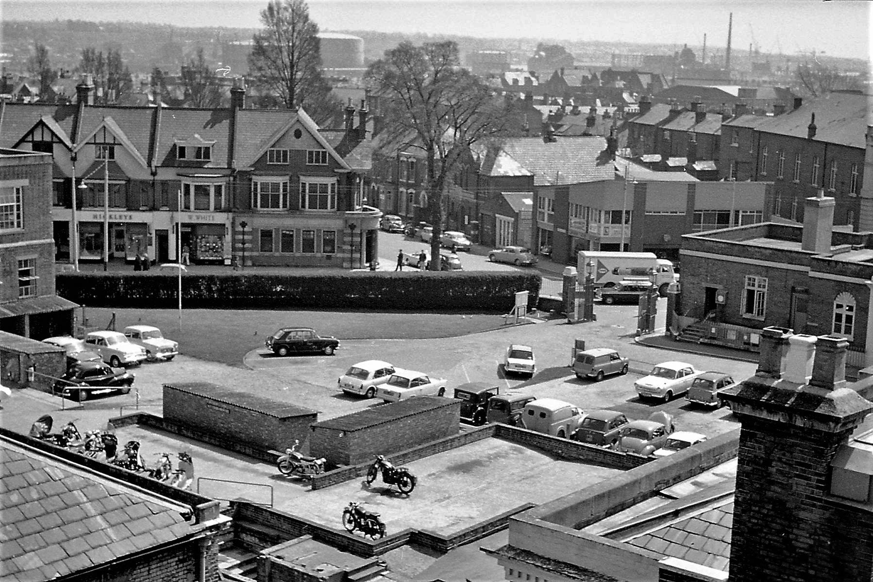
The main buildings at the centre of London Road were there in 1870 but almost totally destroyed by wartime bombing in 1940 and hastily-constructed buildings were erected at OSO Crabwood and Chessington. North of this in the 1870s, is what appears to be parkland with a small observatory and on the corner of The Avenue and Rockstone Place is the Director General’s house, a large townhouse that was indeed used by the Director General until it was decided that the house should be used for offices instead.
In the 1870s or 1880s, then Director General Henry James erected a photography building with a glass roof, this was used for pioneering the technology of Heliozincography and printing plates were hung up outside this building and exposed to the sun. This became obsolete quickly and was soon demolished to make way for printing operations.
Later on, to the NW was ‘The Studio’, a building with a glass roof that was presumably used for photography and helio. In the 1880s, a building for printing was later erected between the DG’s house and the main buildings but this appears to have been replaced with a larger building by 1910. This was a double-height space with large windows. Both of these buildings appear to have remained until the 1970s.
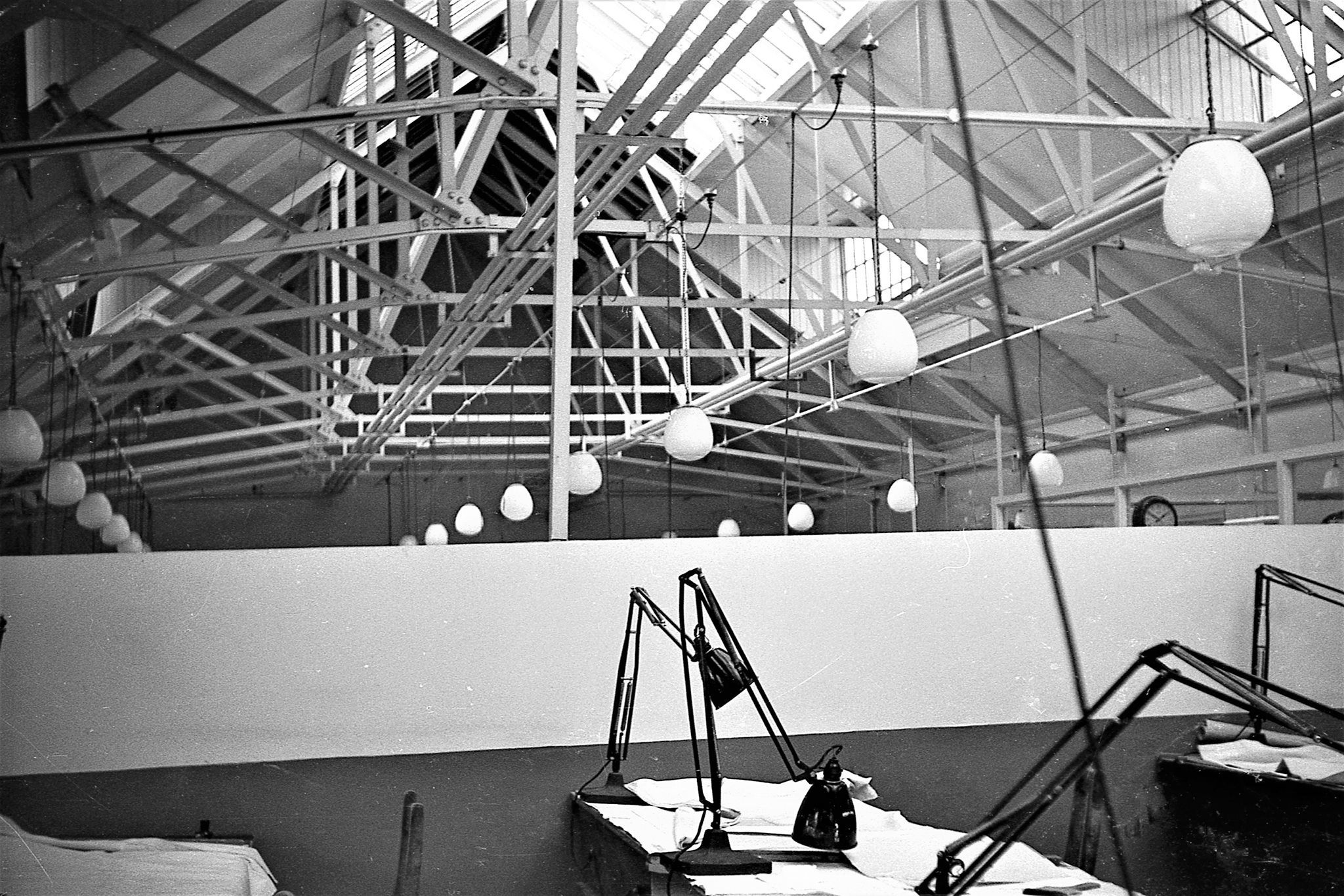
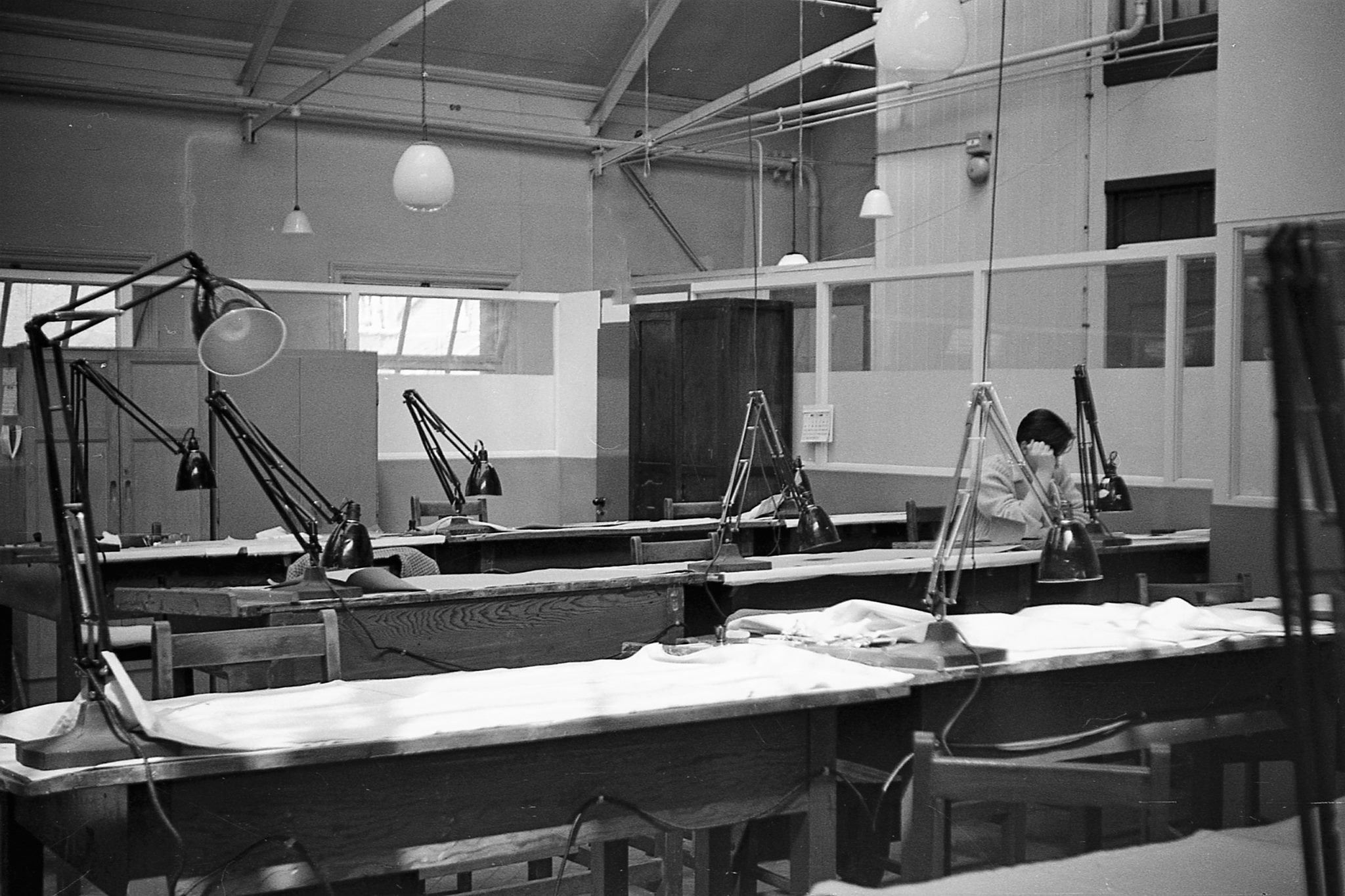
London Road LSD3 (Large Scale Drawing) in 1961. 
LSD3 (Large Scale Drawing) partition at London Road in 1961.
To the western extremity of the site are various small buildings (ex houses?) used as workshops and the ‘cookhouse’. These follow the line of Carlton Crescent.
All that remains of the London Road campus is the Western Range (a small barrack block at the south extremity of the site), the houses along Carlton Crescent and the Director General’s House, now sold off and used as offices for a law firm. The other buildings were either destroyed by bombing and never rebuilt or demolished after moving to Maybush.
In 1967, some staff took photos of London Road to show how it was, similiar to the photographic survey undertaken at Romsey Road prior to the move to Explorer House.
The Ordnance Survey buildings, apart from the Director General’s House, West Pavillion and buildings 23, 24 and 25 on the map below were demolished by 1973.
The Courts of Justice building was erected on the London Road site in the late 1980s/early 1990s. This was roughly where the print works was.
The Magistrates’ Court was erected between the earlier court building and the DG’s house in around 2000. This was roughly where The Studio was.
GaryTull 19 May 2011 (UTC)
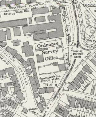
The London Road map
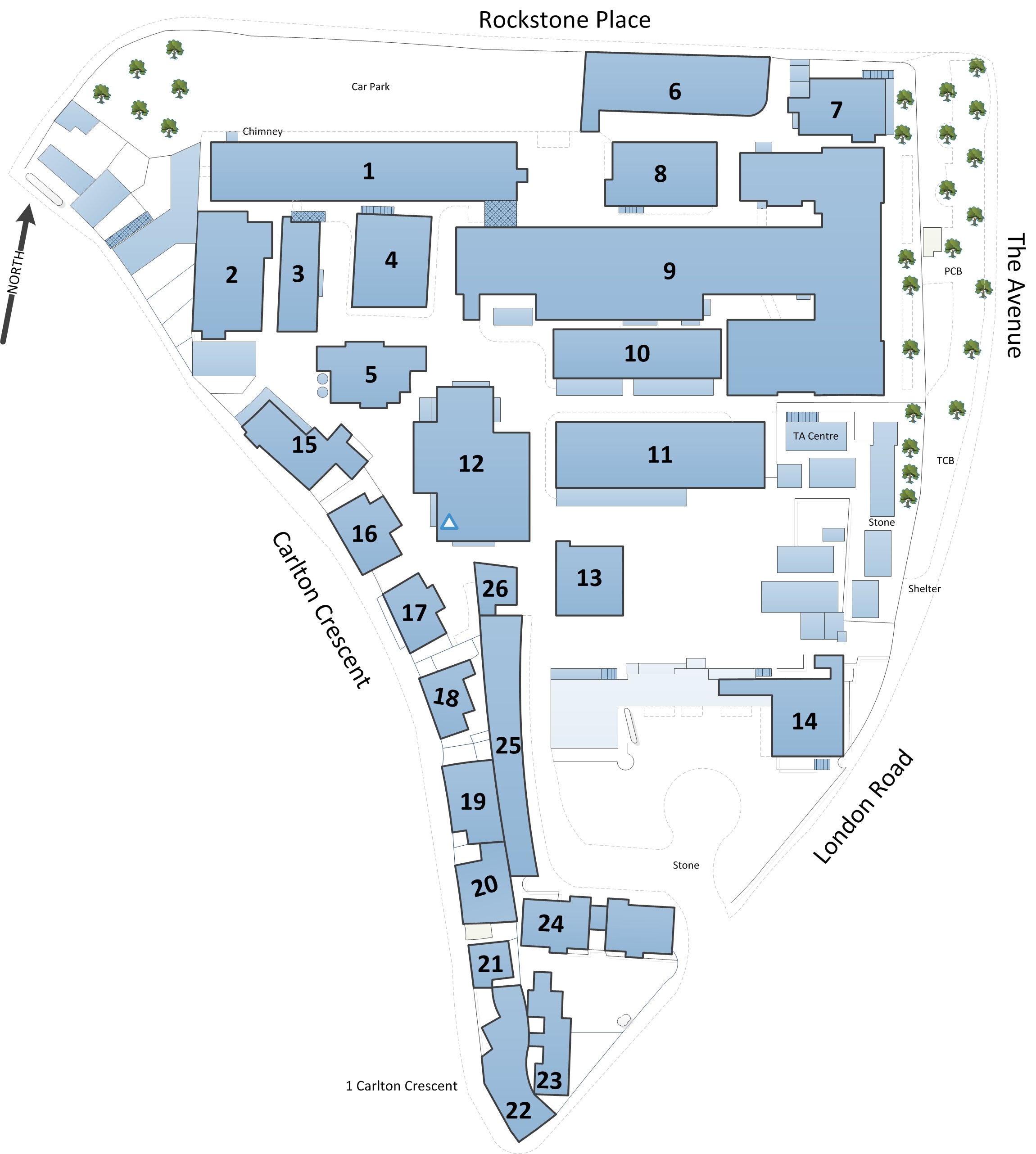
A discussion about what the buildings at London Road were used for resulted in the need for some form of identifying each building on a map. Originally, numbers were merely superimposed on the low-resolution large-scale map I had pieced together but this was poor quality. Based on this is this new map of London Road, traced from the aforementioned large-scale mapping. The original map’s age is unknown apart from being between 1955 and 1970. The descriptions here were based on the situation between 1964 and 1969.
There is definitely no guarantee of accuracy here; most of these buildings were demolished before I was born so it is largely a compromise between guesswork and artistic licence. It is not always easy to tell what was a building, what was a fence, where there were gates and so on.
Also, for that reason, some of the buildings numbered may not actually have been part of Ordnance Survey’s site. I have simply included every building enclosed by the triangle of London Road, Carlton Crescent and Rockstone Place.
The building numbers have no significance at all and are only used here to identify them against a list of numbers with information about what they were used for, where known. I do not know if there was a numbering scheme in use; if there was then I will update the map to reflect any information I discover on that subject.
It appears that it was a closely-packed site, with several buildings having more than one floor, in contrast to the single-storey huts erected at OSO Crabwood and Chessington, with dozens of individual buildings of various ages and designs. It is apparent why
Here is the map itself:
- Building 1 was Photo Drawing at the right-hand end with Map Production Test Group taking up the other half and several carto sections on the upper floor.
- Building 2 – store and administration.
- Building 3 was the workshops.
- Building 4 held the Photo section on both ground and upper floors, with part of the upper floor also being used as a Carto training area.
- Building 5 held the Filmsetter section on the ground floor but not sure what went on above that.
- Building 6 was the staff canteen.
- Building 7 is the former Director General’s House; this is now used as offices by a law firm but is still referred to by its original name and bears a blue plaque to commemorate its former use. Use of the house was originally one of the perks of the DG’s job but this was given up by one DG who decided that it should be used for much-needed production instead. At the time the map represents, this was used as administration offices but also some carto activity. The house was threatened with demolition in the late 1970s as it was in a poor state of repair but fortunately it was renovated.
- Building 8 was part of the Photo section on the ground floor and more carto upstairs.
- Building 9 was by far the largest building at London Road; this post-war structure was used mainly for printing: the right-hand end was the Proving section on the ground floor with the long spur housing Printing and more Carto sections on the upper floor.
London Road’s Drawing School at lunchtime in 1961 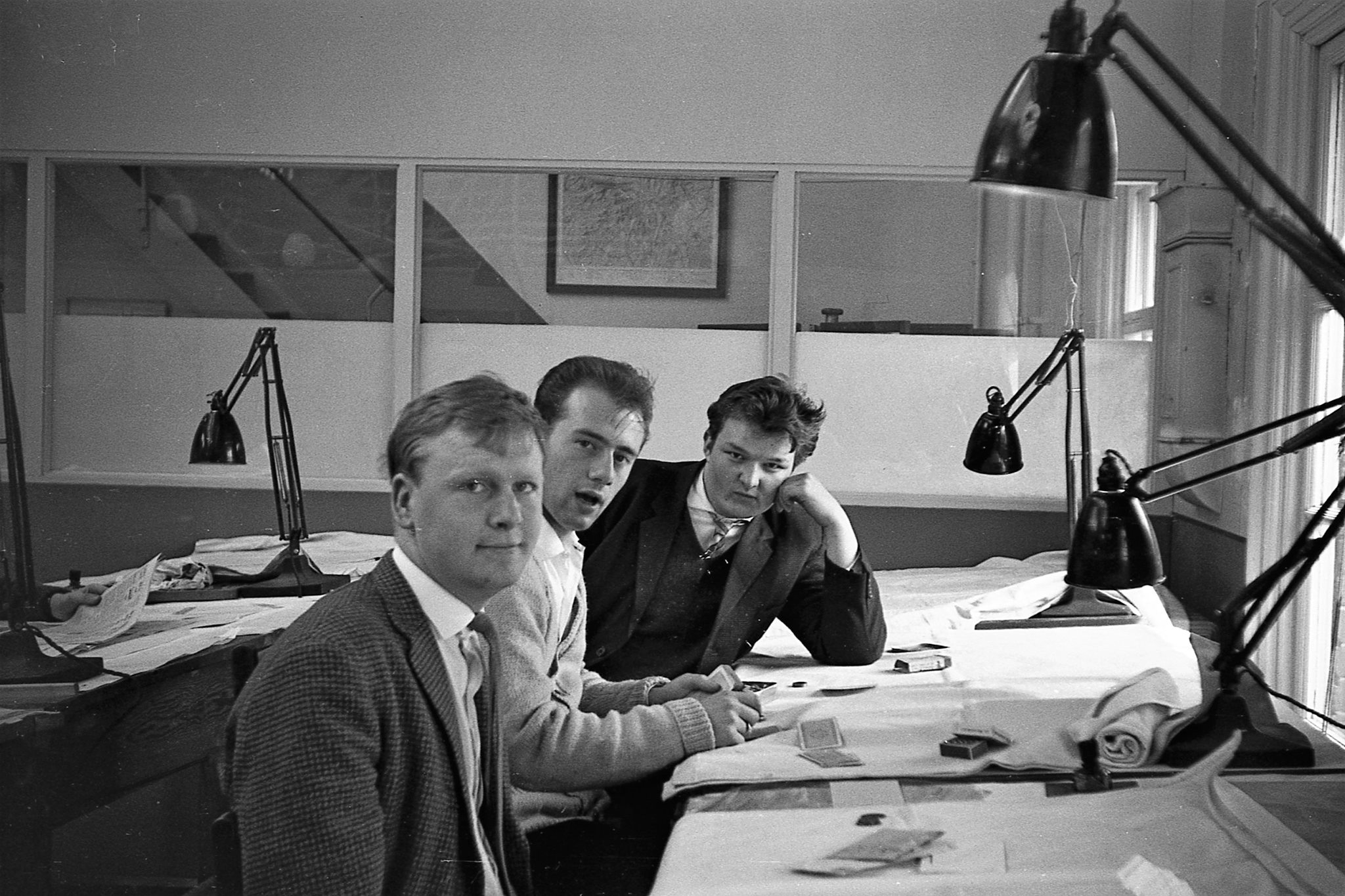
London Road Drawing School at lunchtime in 1961
- Building 10 and the adjacent part of Building 9 was the Helio and plate-making section.
- Buildings 1-10 were roughly where the Magistrates Court, constructed in the late 1990s, now stands.
- Buildings 11 and 12 were store rooms. Both of these large buildings were demolished to make way for the Courts of Justice building in the late 1980s. Building 11 was the site of the North Range, one of the main buildings at London Road that was gutted by WWII air raids.
- Building 13: West Pavilion – this Victorian house-type building appears to remain and is now connected to the Courts of Justice buildings. It was originally used by Ordnance Survey as engraving rooms.
- Building 14 was the remains of the South Range, an impressive landmark building that was sadly destroyed during the Blitz. Its remains appear to have gone to make way for the aforementioned Courts of Justice building.
- Buildings 15 and 16 are thought to have been used for administration but also the exam section. Both of these were retained although the gap between them appears to have been filled in.
- Buildings 17-21 are large Victorian townhouses that may or may not have been part of the Ordnance Survey complex. These were kept and used as offices/residential.
- Building 22 is currently used as a hi-fi shop, although it appears to have been a bank in the 1960s. This was probably not a part of the Ordnance Survey site.
- Building 23: a two-storey Victorian building that is now used as offices.
- Building 24 or ‘The Guardhouse’/Barrack Block (this includes both the building with the number on itself and the adjacent joined block) is arguably the most attractive building remaining at London Road. This is used as offices now but was originally security and reception, due to it being adjacent to the main gate off London Road. New recruits had to report to here on their first day. It was built in 1867.
- Buildings 25 and 26 are the ‘Western Range’ a row of Victorian two-storey buildings now used as offices. While building 25 remains, it is unclear whether the much-smaller building 26 has remained as well.
Other buildings Part of the site, adjacent to building 11 and fronting The Avenue, is clearly marked on the map as ‘TA centre’. This small group of buildings may originally have been part of Ordnance Survey’s operations.
The western corner, of Carlton Crescent and Rockstone Place, has a small group of white Victorian terraced buildings, some with three storeys. These may well have been part of the site but remain as offices.
Not shown on the map but nearby in Carlton Place, immediately to the south-west of the main London Road site was the Boundaries Branch. This was near the Cricketers pub.
GaryTull 15:32, 26 November 2012 (UTC)
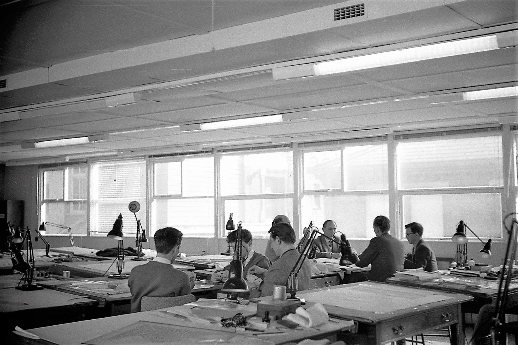
London Road LSD2 (Large Scale Drawing) in 1961 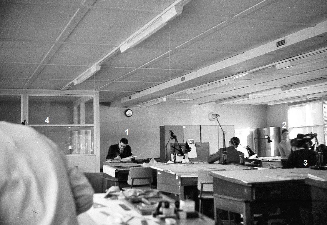
London Road LSD2 (Large Scale Drawing) in 1962.
Last updated on Wednesday 17 February 2021 by GaryReggae