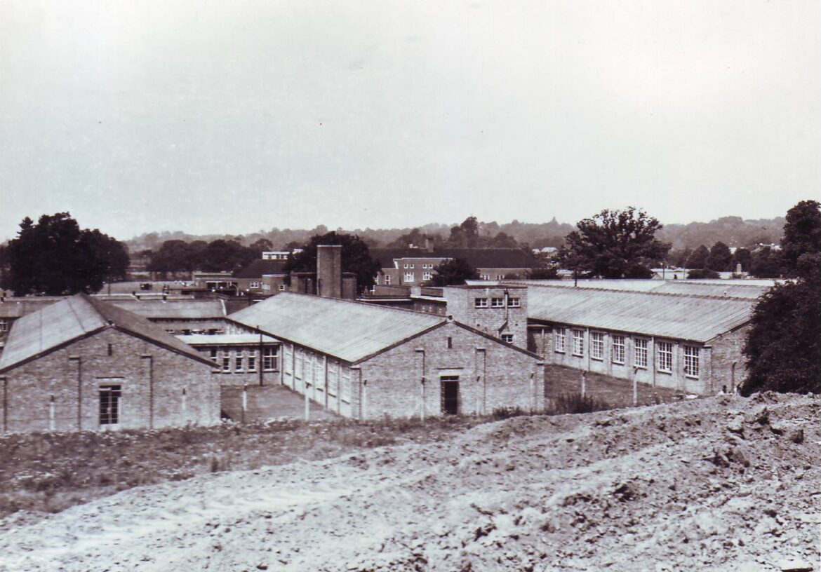
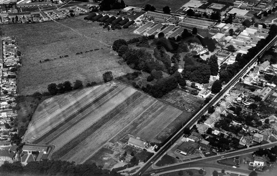
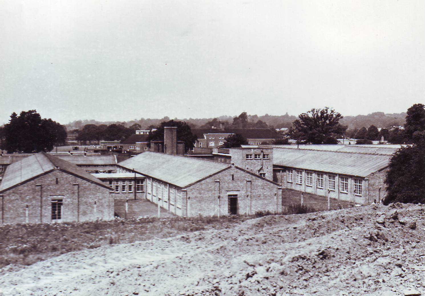
A complex of temporary buildings near Crabwood House was erected in the 1940s and was mainly used for medium- and small-scale reproduction. Some of the huts were demolished immediately after the occupation of the new Maybush buildings in 1968 or 1969 but others lasted until the late 1990s.
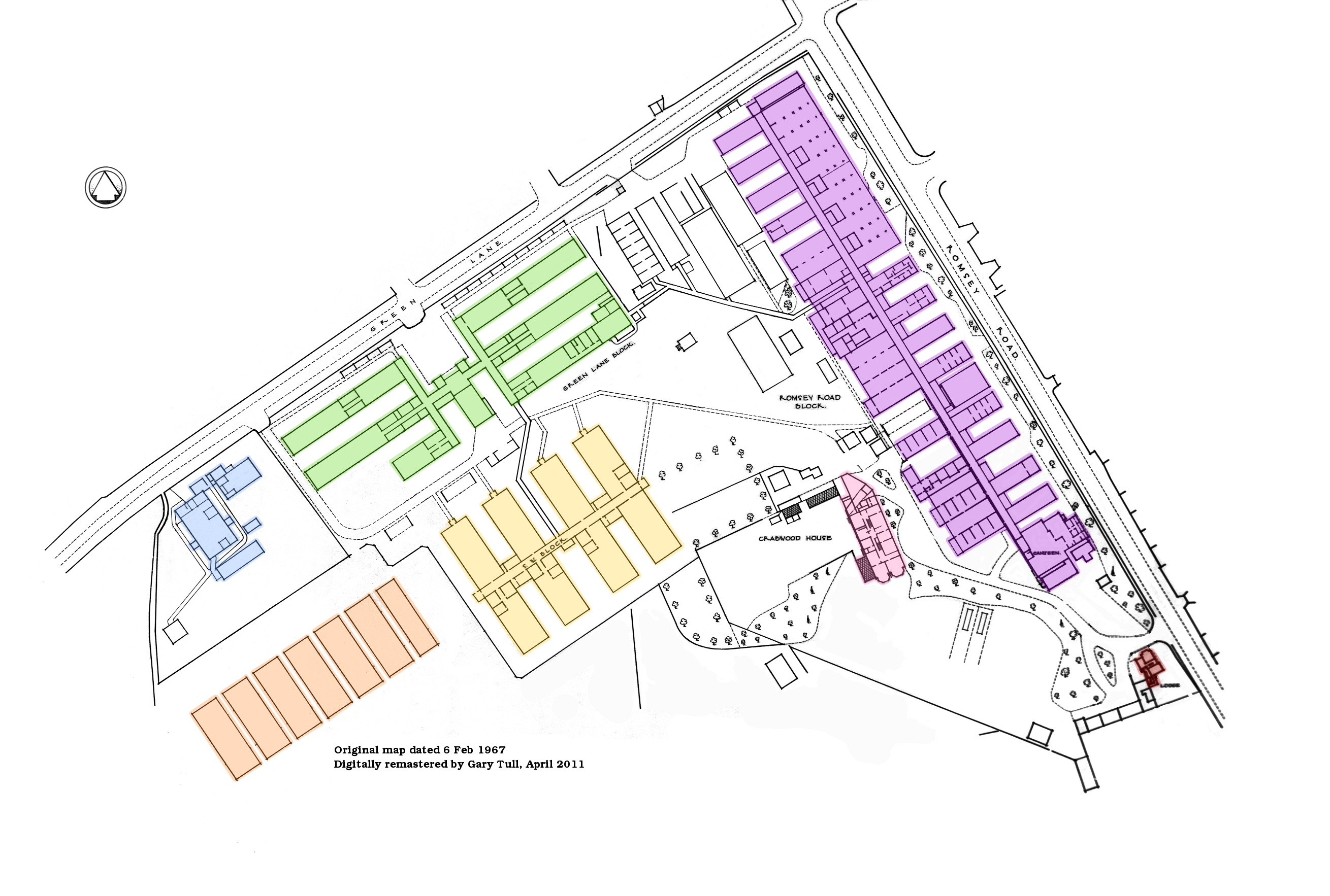
Legend:
- Blue = Spraying Huts
- Green = Green Lane Block/Temporary Office Building
- Purple = Romsey Road Block
- Pink = Crabwood House
- Yellow = South West Block/H Block
- Red = The Lodge
- Orange = Nissen huts
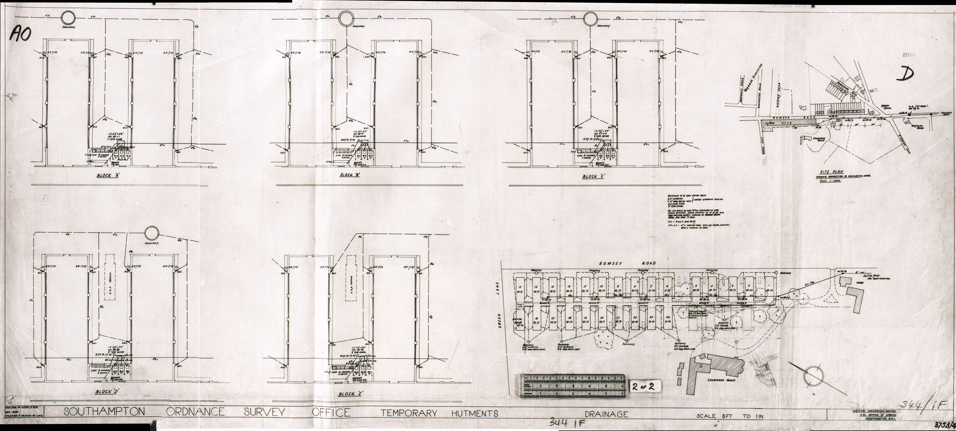
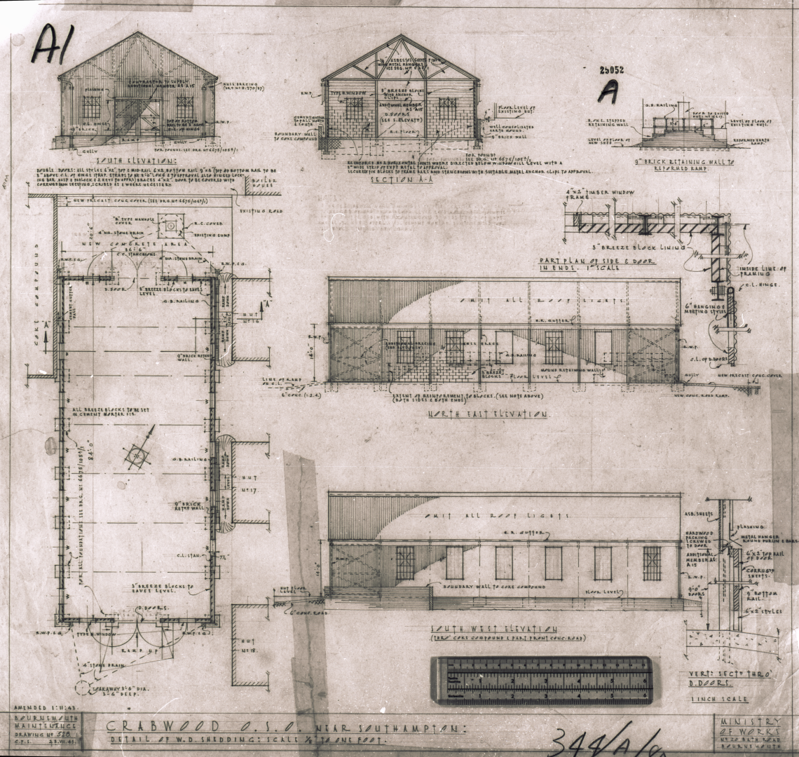
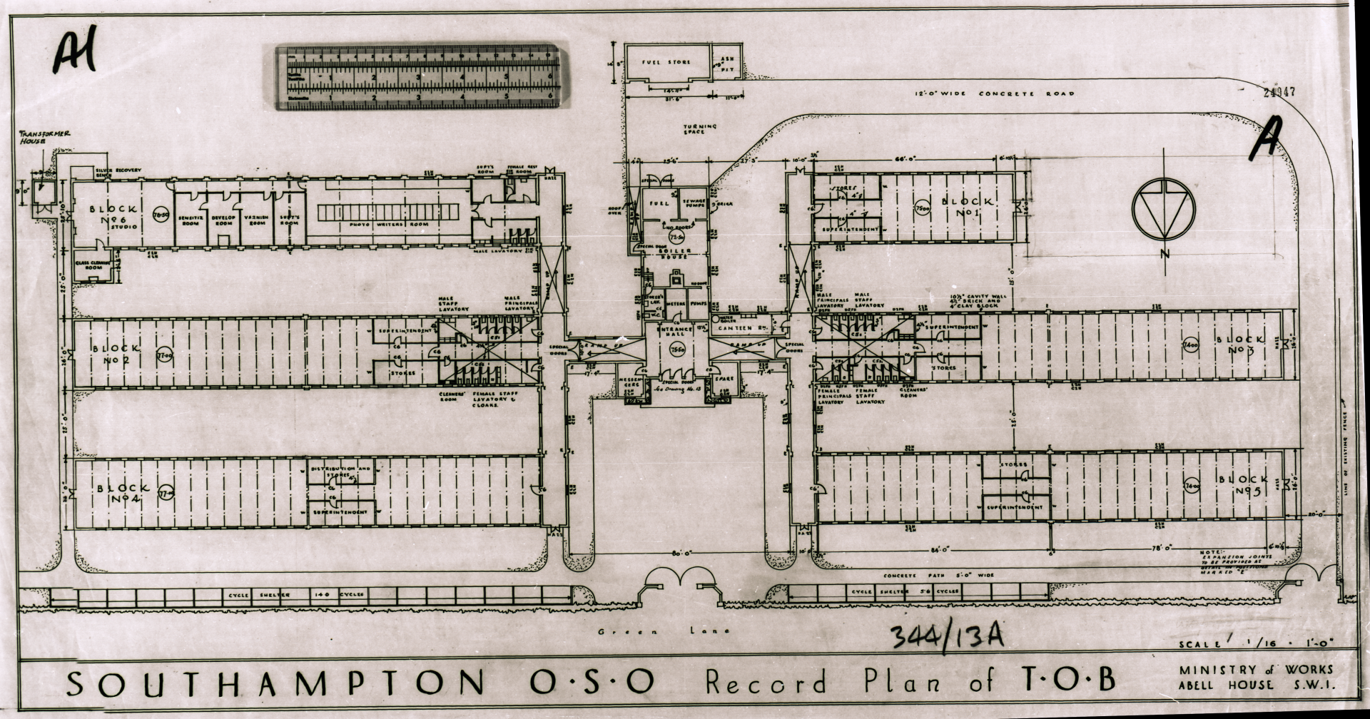
In 1940, Ordnance Survey’s London Road HQ was badly damaged by enemy bombing and the main headquarters was to move to the new site at OSO Chessington (opened 1943) but many operations, particularly reproduction and cartography were moved to a new complex of huts near the early 1820s-built listed building, Crabwood House. There were 24 main huts (plus a boiler house) to start with, running either side of a long central corridor (parallel with Romsey Road) and this was extended shortly after with four extra huts on the south side. This block was known as the Romsey Road Block.
Some spraying huts were also built in the early 1940s, off Green Lane so a fair distance away and six Romney/Nissan Huts were erected nearby.
A new ‘Temporary Office Building’ (TOB) was erected along Green Lane in circa 1945, which contained drawing offices and a camera studio and was followed in the early 1950s by the SW Block, which consisted of two H-shaped buildings used as drawing offices.
The site was known officially as ‘OSO Crabwood’ and I have managed to find some ‘technical slides’ dating from 1939 to the 1970s. At first, the scanning process I had available did not produce very clear results – clear enough to see but not clear enough for fine detail such as reading dates etc – but a new film scanner in 2023 has worked wonders in extracting the details in these historic and, in my opinion, attractive images. Many have been rescanned now as they are a lot clearer than those from my flatbed scanner. I thought I had scanned them all in on form or another but there were 60 or so that had not been touched and I have also catalogued all the images now in a purpose-built database.
The building layout on this map is interesting. I imagine the place must have resembled a huge barracks or military hospital. It was a huge complex of single-storey huts, with the only exception being Crabwood House itself. The Romsey Road block was originally individual wings off a very long corridor but over time, various extensions were made and some of the gaps filled in (as can be seen at the far North of the map). There are several buildings that don’t appear to belong with any of the aforementioned blocks; I think some of these must have been used for storage of paper or glass plates.
Romsey Road block
A long row of single-storey huts were put up along Romsey Road – between Green Lane and where North Block is now. These huts had a central corridor ‘spine’ with huts branching off both sides. These appear to have been used mainly for production activities – printing, Photographic and Helio – and many of the wings were joined together and extended to create several large production floor areas. At the SE end of this block was a canteen that was the same size as a standard hut to start with but was extended several times to become much larger. There were originally 24 huts plus a boiler house and separate Nissen Hut here but four additional huts were built to the south end of the Block shortly after. Early plans of the site also show air raid shelters between many of the huts (or were they a top secret bunker?) and there was a ‘decontamination centre’, ARP hut fire pump hut and others.
The central spine corridor was not fully enclosed and so it could be rather damp and draughty in the winter!
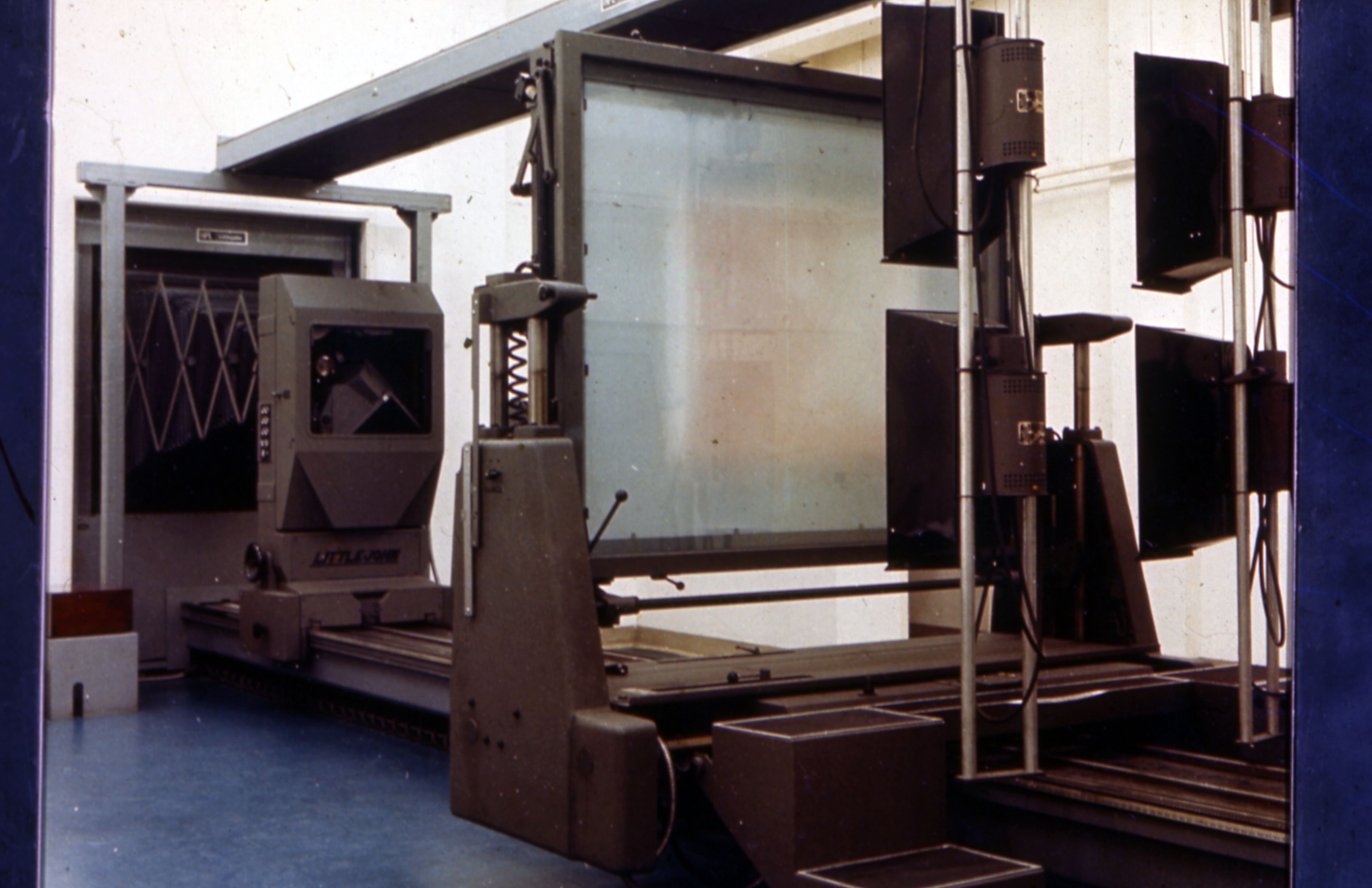
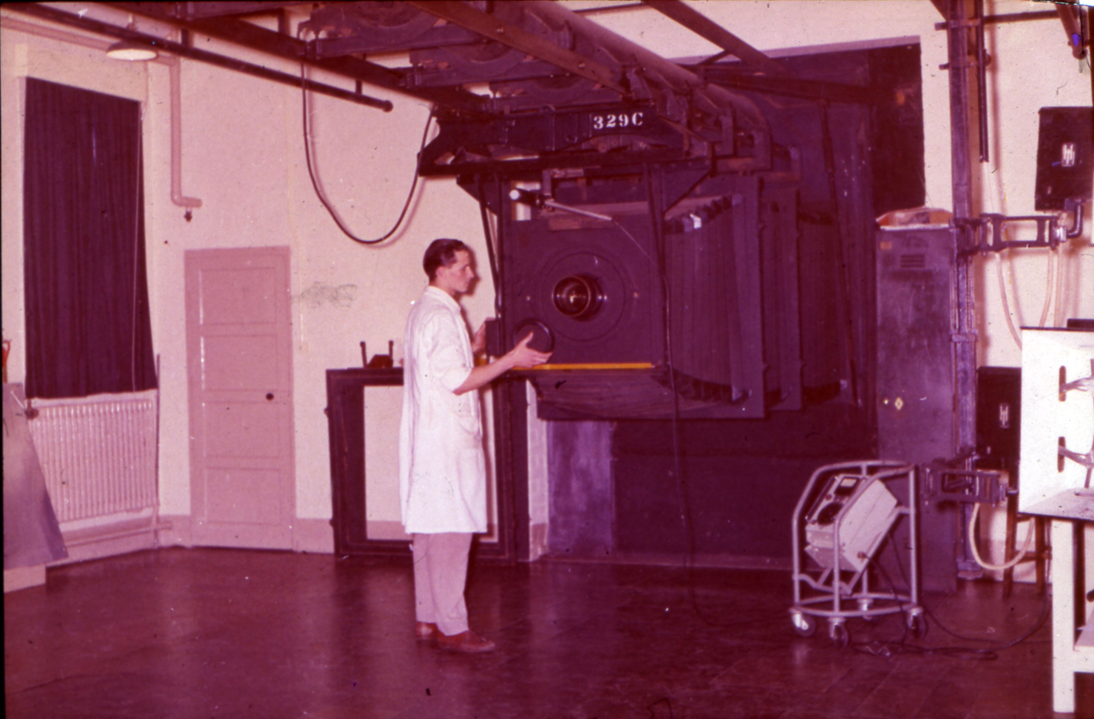
Over time, all but four or five gaps between the main huts were infilled, the last two being as late as 1961. There were other extensions behind the SW end of the huts, with the largest and most recent being a large new Camera House behind huts 21-22 constructed in 1960/61. I believe this contained the new Littlejohn camera that was moved to Maybush on completion of the new Photographic area there between 1968 and probably 1970.
There were also several other buildings connected to the Romsey Road Block – one air conditioning plant plant and a ventilation plant from the early 1950s and the earlier ‘WD Hut’ behind Huts 16/17.
The Romsey Road block was the first section of the temporary buildings to be demolished – fairly soon after the opening of the new head office building. The SE part of the site was demolished to make way for the North Block car parks, with some of the foundation slabs being used as hardstanding. The NW end was demolished around the same time (according to historical 1:2500 scale maps) but nothing was done with it for a while. In the 1980s, a smaller temporary building complex was erected at that end, at the corner of Green Lane and Romsey Road. The maps show this as being ‘Government buildings’ but it was actually used as a temporary court; see below for more info on that.
In the mid 1990s, the NW end of the site was replaced by housing – known as Kern Close, an appropriate name as kerning is a term relating to printing. Land Registry data suggests these houses/flats were put up around 1996/97.
An alternative theory about the road names given to the residential closes built on the site of the huts is that they are related to surveying equipment manufacturers – Watts, Cowley and Kern.
Hut numbers and usage:
- Hut 1 starting with the most important, is the canteen. An army marches on its stomach and all that!
- Huts 2-3 and 4-5 were one of the later infill schemes – in 1961 – for Photo Litho and Photo Drawing I believe.
- Between huts 5 and 6 was a Plate & Negative Store, built in 1949
- Hut 7 I am unsure as to usage.
- Hut 8 was part of the Photographic section
- Hut 9 was home to a 1:1 fixed camera
- Huts 10 to 15 were the main print floor and contained a Mann machine and one or more Crabtree presses, an appropriate name for OSO Crabwood! The Crabtree machines were presumably moved to Maybush as I have seen photos of them there. They were also used at London Road. This area was air-conditioned from the early 1950s.
- Huts 16 to 20 were used for Helio and one of the later infill extensions, in the early 1960s.
- Huts 21, 22 and 23 were used for Helio/Photographic.
- I believe 25-28 were used for stores, one of the earlier infill schemes!
- The ‘WD Hut’ – no idea what the name refers to. This was originally used as a paper store but later by Helio.
The Lodge/workshops
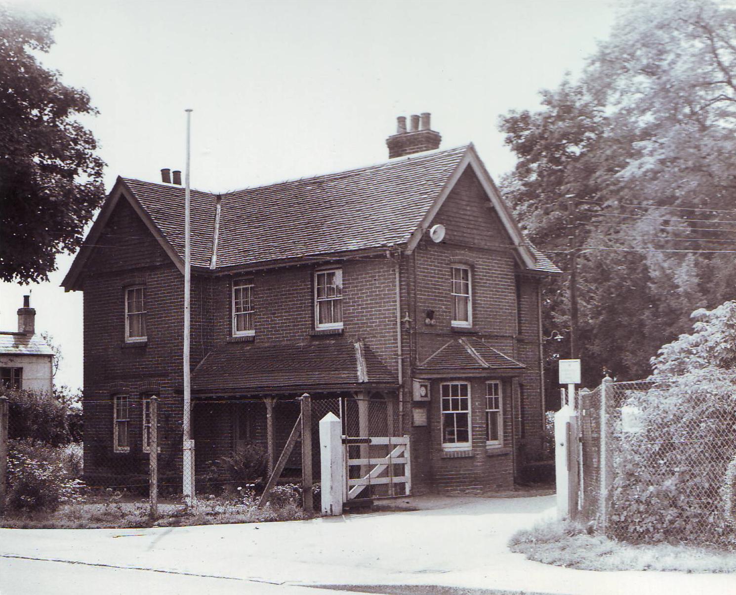
Where the car park in front of North Block is now, there was a lodge, or gatehouse. This would presumably have been part of the Crabwood House estate. Unfortunately, it was demolished shortly after opening of the new head office building and so were the adjacent houses.
There was a small complex of workshops attached to the lodge and behind it for carpentry, plumbing etc and a small garage as well.
Green Lane Block/Temporary Office Building (TOB)
The Green Lane Block, or Temporary Office Building was a large single-storey building used for offices. The main entrance to this was roughly where the driving test centre in Green Lane is now. A corridor perpendicular to the main entrance and on both sides of the entrance hall led to three long office spurs on each side. I am not aware of any photos that exist of the TOB but the entrance hall at least appears to be of an attractive design, unlike most of the very utilitarian huts surrounding it.
The TOB front entrance was in an Art Deco style and looked more like the entrance to a cinema than an office; the boiler house chimney was even disguised as a central tower that brought symmetry to the entrance. If anyone has any memories of the TOB then I would love to hear from you.
The TOB was described as a temporary office building but much of the space was used for other activity, particularly in the most western spur, which was used for ‘Studio 6’ where the Monotype camera was installed. The large cameras required film processing darkrooms on the film side. There was a photo writing room in the same spur.
Spur number one was only half the length of the others. It was designed to be extendable but plans were not submitted for extension until as late as 1964.
While I originally thought that the TOB was demolished at some time between 1969 and the 1980s, it actually appears to have been much later than that, with it remaining until the mid 1990s according to historical maps. It has now been replaced by the driving test centre and houses (Watts Close), both of which appear to date back to around 1997. The driving test centre was originally housed in a different building but I am not sure exactly where. One interesting fact though, is the gates to the driving test centre look exactly the same as the gates to the OS site – this was obviously once an entrance to the OS complex that was here.
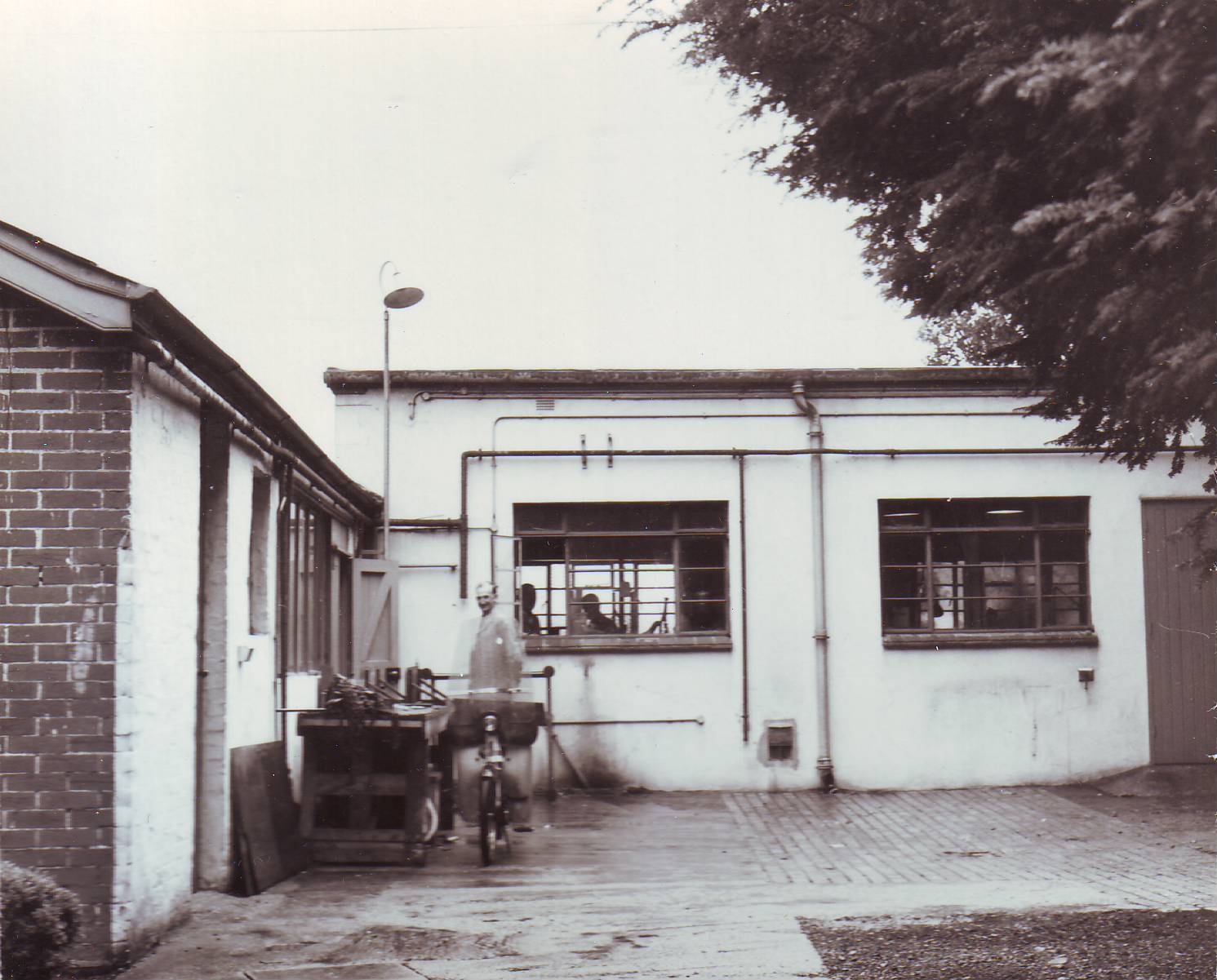
Spraying complex
Further along Green Lane and next to the TOB was a complex of buildings described as ‘Spraying rooms’. There were presumably used for paint spraying but may have been glue or some kind of varnish. These were adjacent to the large electrical substation that is still there but the rest of the buildings have gone to make way for Cowley Close, circa the late 1990s.
Part of the the spraying huts were later (1962) converted into an instrument repair workshop.
image 10F Mar 1970
Romney/Nissen Huts
Six army-style Romney Huts and one Nissen Hut were located behind the Spraying complex. It is believed that they were originally used by the Ministry of Food as a ‘buffer depot’ of some kind (wartime probably), but they do appear on plans of the OS buildings at Maybush and were subsequent used by Ordnance Survey as site maintenance workshops. They were also, more notably, used for constructing the floats Ordnance Survey staff used to make for the Southampton Carnival. It appears that they were demolished in the early 1970s, although the concrete floor slabs were left for some years afterwards.
IMAGE AA16
H Blocks (South-West Block)
These were one of the more recent additions to the temporary buildings. Located behind the TOB, these two adjacent ‘H’ shaped buildings were constructed in the early 1950s and used as a drawing office. I believe that large-scale carto training was based here following the move from London Road. In later years, they were apparently occupied by the Royal Commission for Ancient and Historic Monuments (RCAHM) and I have also seen a reference to the Property Services Agency. The H blocks themselves were not ancient or particularly historic, although they probably hold some memories. They were the last of the main temporary structures to be built and the last to be demolished – in the late 1990s. The site was occupied by the Maybush Green Car Park but you could still see the concrete floor slabs as the foundations were used as hardstanding.
Other buildings
There were numerous smaller buildings around the large complex already mentioned, with the most prominent ones being:
- Negative Store (North) – 1950
- Negative Store (S) (1954)
- Graining Hut
- Paper Store (1941)
There was also an ‘Open Fuel Dump’ , several air-raid shelters and various stores and plant rooms plus cycle sheds and a generator house. Also, many of the buildings were connected by a covered way, although this was probably a corrugated sheet fabrication rather than the grand concrete port cochere in the new head office building.
St Peter’s Church/Church Hall – not a part of the main OSO Crabwood site but further along at Maybush Corner, the Church/Church Hall were converted into accommodation for the Air Survey team in the early 1960s. This is presumably after the church was relocated to its current site in Irvine Walk in 1958-59. The Maybush church/church hall were temporary buildings themselves, being ‘tin chapels’.
It may not be a building, but it is also noted that the rectangular(ish) field between the ‘H’ blocks and Crabwood House was known to many as ‘The Orchard’. Originally an extension of the car park (with the parking spaces between the trees!), this area was later enclosed and until recently was used by the Little Explorers’ Nursery/Playscheme as a play area for the kids.
Temporary courts
In the early 1970s, there was a lack of Crown Court capacity in Southampton as the two courtrooms in the Civic Centre were shared by Magistrates courts. Due to an ever-increasing case load, the Property Services Agency (PSA), the government agency that managed Crown property was asked by the Lord Chancellor’s Department was asked to identify sites in Southampton that would be suitable for temporary court buildings. The plan was to build a new courts complex in London Road eventually but as that was not expected to be complete until the 1980s then the NW corner of the former Romsey Road Block site was identified as “the only suitable site”.
The court was on the site of part of the old Romsey Road huts complex, right at the junction with Green Lane. The main courtroom accommodation wings were temporary buildings but the link block was meant to be more permanent as there had to secure accommodation for persons in custody. These buildings were (not surprisingly) very utilitarian.
Mechanical and electrical
This subject could fill a whole page in itself so will probably evolve into a separate spin-off page!
Heating: Romsey Road Block had its own Boiler House (BH), as did the TOB. The TOB’s boiler house and chimney was extended in the early 1950s to serve the new SW Blocks. There was a large water tank above the Boiler House.
Air Conditioning – huts 10-15 (Print) were air-conditioned from the ‘AC Plant House’ from the early 1950s. The paper store and TOB camera Studio 6 and its processing rooms was also air conditioned, from Plant Room A. Huts 16 to 24 (Helio/Photographic) I believe were also air conditioned (from Plant Room B), as was the new early 1960s camera studio. The numerous arc lamps used were ventilated by ducting very close to the lamp and there were ventilated processing sinks as well.
image 92E – ventilated sink
Electricity – there was a transformer/switch room between huts 8 & 9 and two standby generators near the new camera studio but I am not sure if/where they were relocated after that was built.
Acknowledgements
The photos on this page are from the Ordnance Survey Picture Collection with thanks. The maps and plans are from various sources, including the HMA, and are the basis of much of my research into this. I have also used Southampton City Council’s excellent planning portal for research, mainly into the later developments, such as the courts. If anyone has any photos or memories of OSO Crabwood, I would be very grateful to see it.
Last updated on Monday 24 July 2023 by GaryReggae