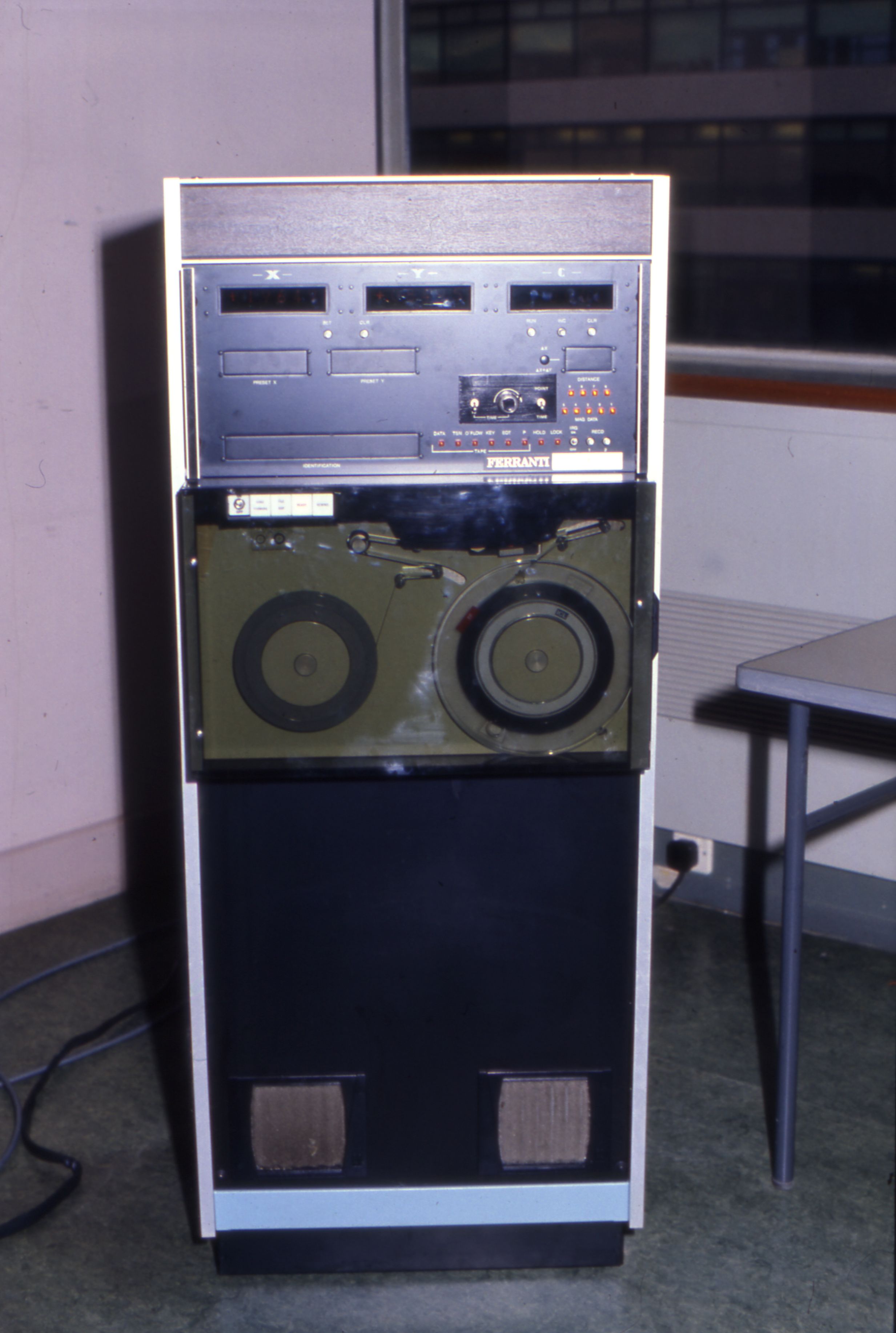
In the early 1970s, OS started digitising its entire library of large-scale maps, this was pioneering stuff and special Ferranti Freescan digitising tables were introduced. This was originally ‘blind’ digitising so the cartographers traced a primitive mouse over the linework with no display screen to show the results. Later equipment had a screen to make the job easier.
Ordnance Survey conducted a trial with the help from Royal College of Art’s Experimental Cartography department (as Ordnance Survey did not have any equipment for this) into digitising mapping in the late 1960s and was ahead of its time with this. OS referred to this as ‘Automated Cartography’ and it was under the remit of Research and Development (R&D).
The first digital map data on magnetic tape was sold in 1971, which was a small-scale map of Great Britain’s coastline, although I am not sure how many people would have bought that, given the equipment they would need to do anything with the data at the time.
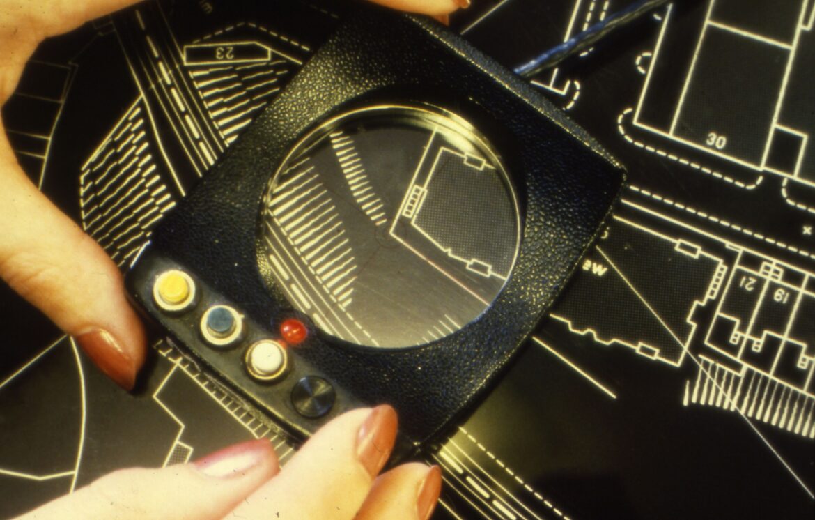
Ordnance Survey tested a succession of digitising work stations from various manufacturers and Ferranti was the successful supplier. Ferranti supplied the first six Freescan work stations in May 1972. and the first Digital Mapping production of large-scale data started the same month. This was a ‘blind’ process, in that there was no screen to show the draughtsperson the work in progress. The task was to trace lines using a cursor/tracking device, similar to a computer mouse but with a glass hole with a crosshair for accurate tracing. Dozens of different types of lines needed to be drawn so the user would move the cursor over a menu of feature of feature codes and press the button to select that category.
The first Ferranti digitising computer (known as no. 1) is now in the collection of the Science Museum! They are a key part of the OS transformation from paper maps to fully digital data.
There was also an successful pilot to digitise contours from aerial imagery, with rotary encoders being added to some of the stereoplotters. This was very welcome, as drawing contours manually was quite tedious!
Experimental trials of other setups
A D-Mac digitiser was trialled, linked to a Wild A8 stereoplotter through a rotary encoder and system of linkages. It all looks very complex indeed!
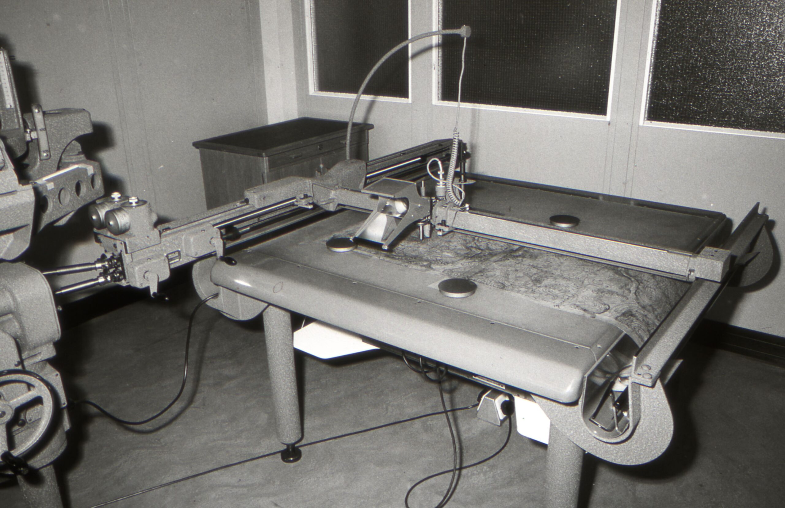
A8 stereoplotter- trialling digitisation of contours 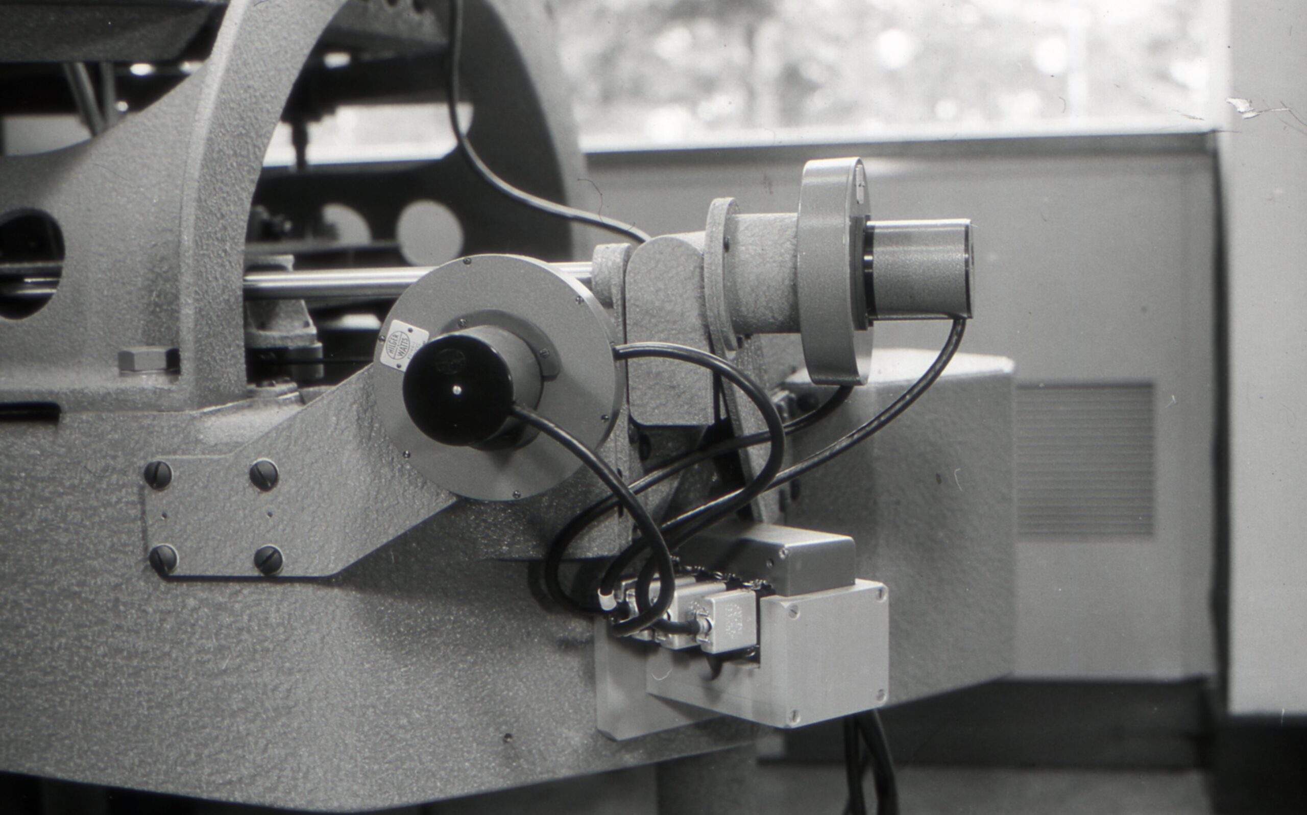
A8 stereoplotter- trialling digitisation of contours 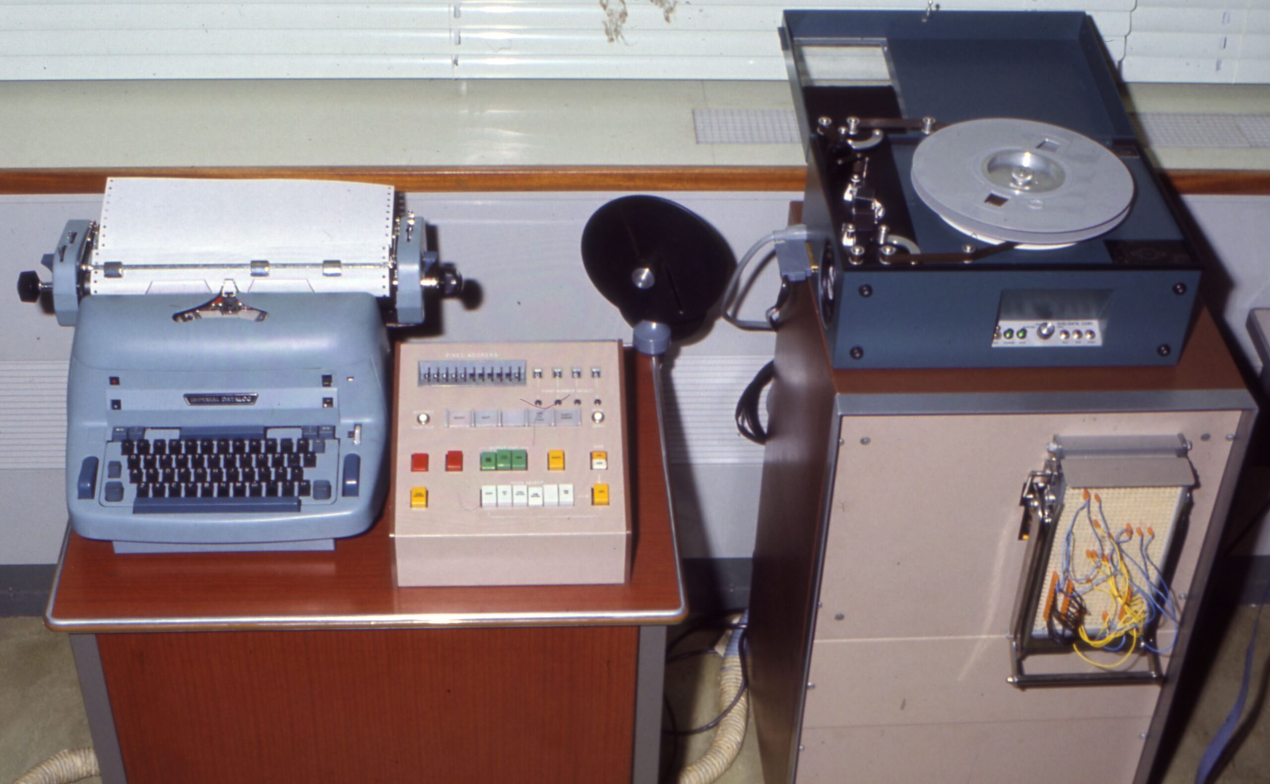
Experimental digitising equipment, 1971 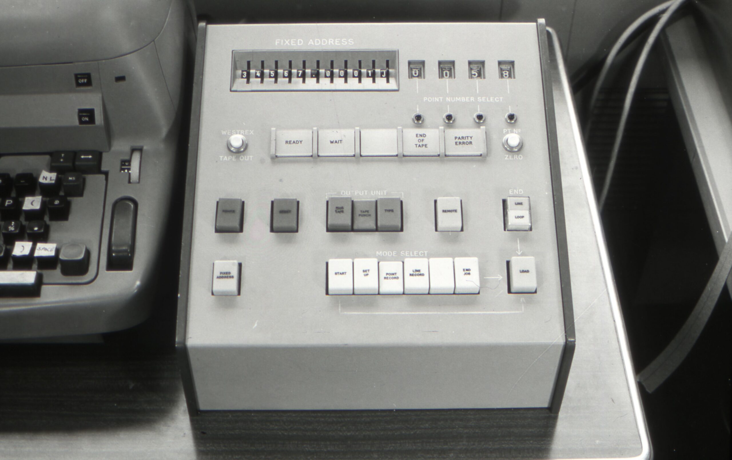
Experimental digitising equipment, 1971 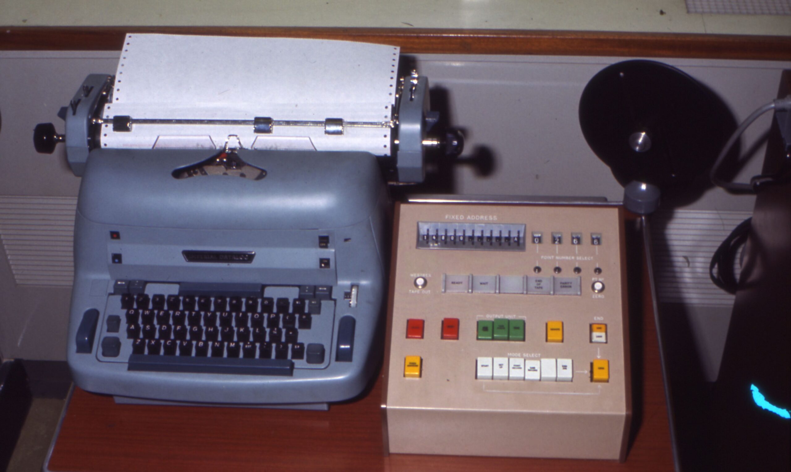
Experimental digitising equipment, 1971 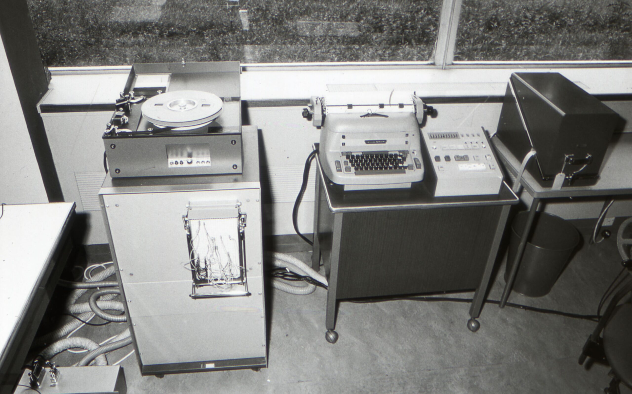
Experimental digitising equipment, 1971
Early digitising photos (Ferranti)


The buttons on the Ferranti cursors had the following functions:
- the yellow button the left was used to complete a feature;
- the green button second from the left was not originally used but brought into use later; it was used to recall a common feature code to save having to keep going back to the menu;
- the white button was used to start/stop the curve routine; and
- the blue button the right was the main digitising button – used to digitise a point.
At the end of each day, the tape from the Ferranti units would be rewound and taken to the Computer Programmers in the W404 area for loading onto the mainframe.
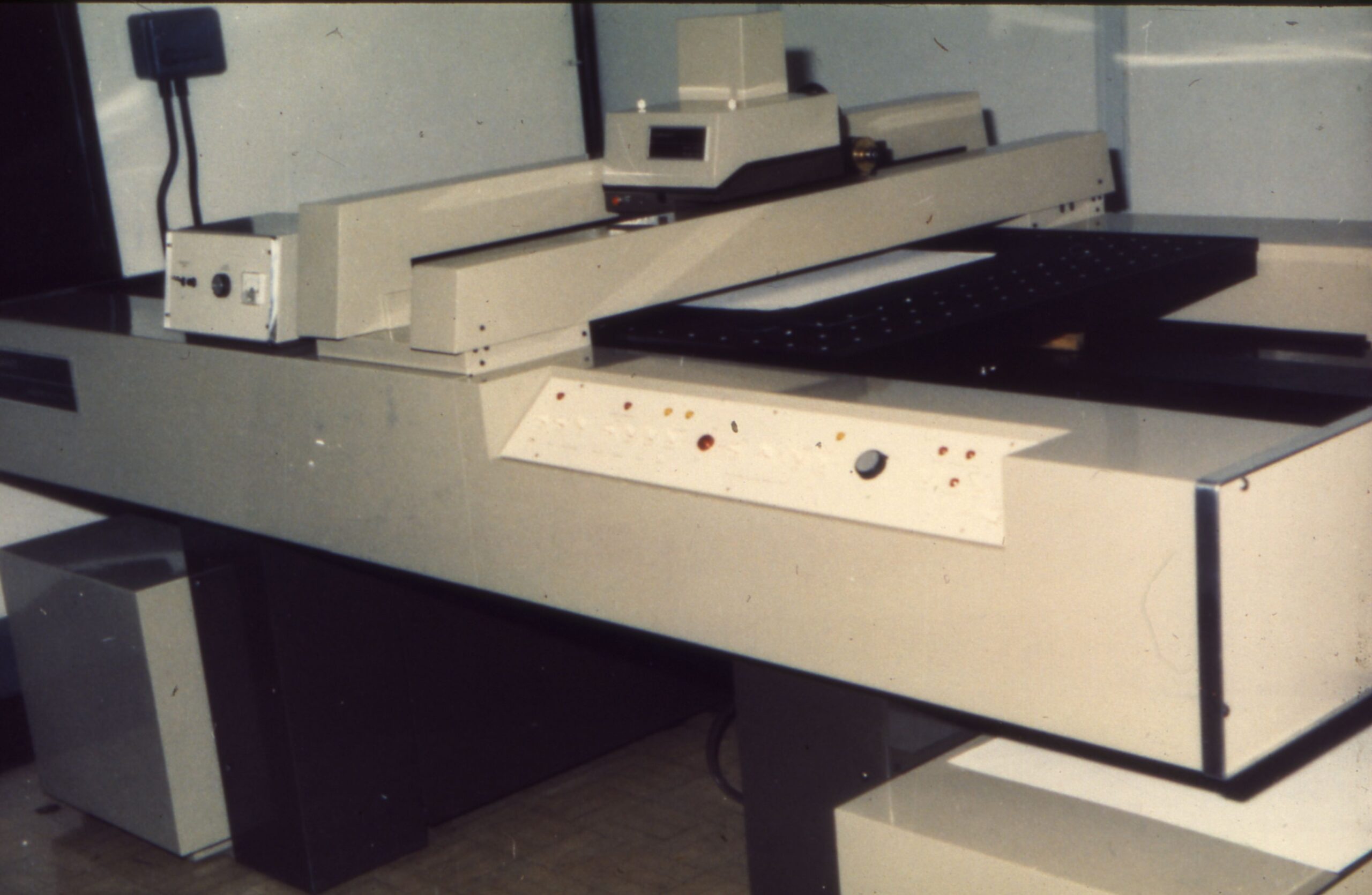
Ferranti master plotter
This huge flatbed plotter was located in the first-floor Repro area of the WRB and was used to output digitised mapping onto photographic film. It had to be operated under darkroom conditions and was controlled by Digital computers located nearby.
It used light-spot projection and was purchased in 1972. The finished product was significantly better quality than that produced by the Calcomp drum plotters used previously.
Ferranti master plotter 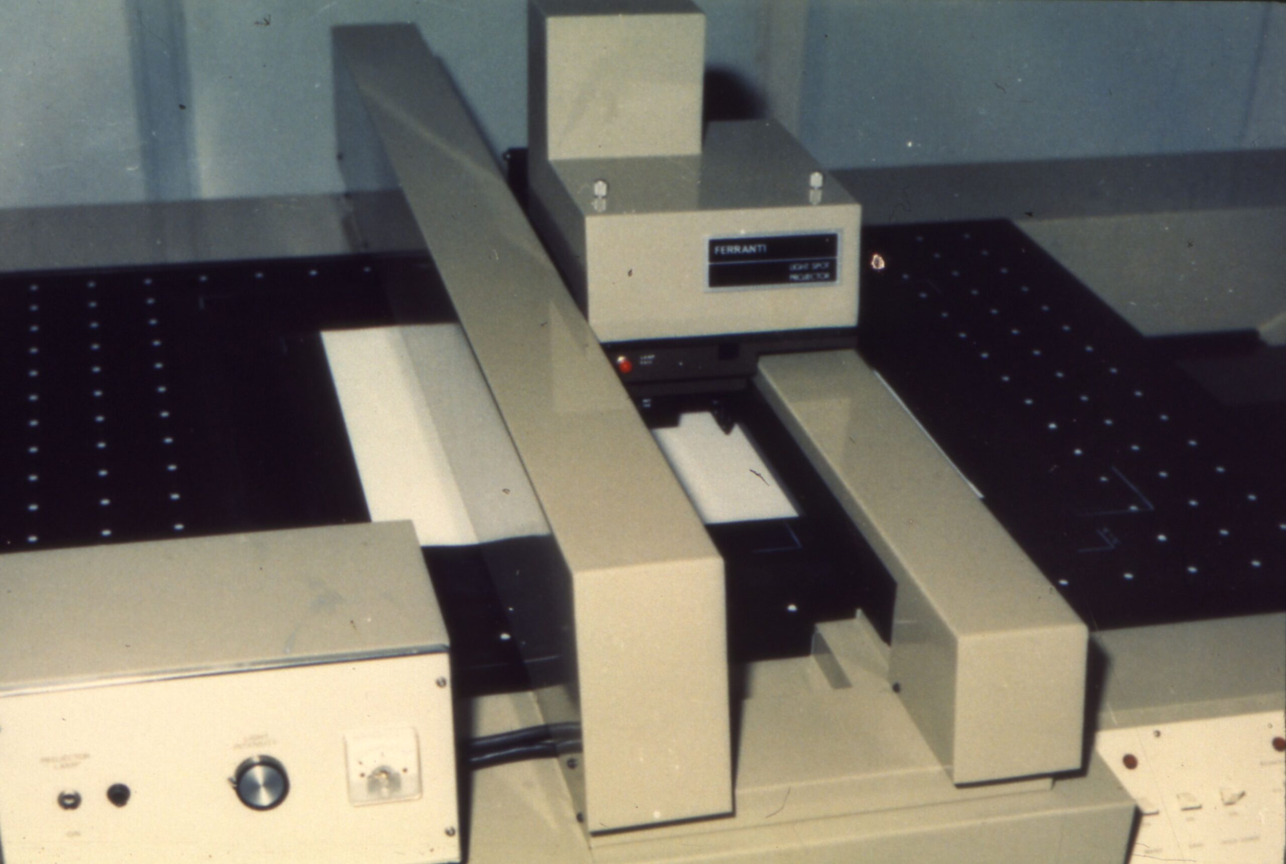
Ferranti master plotter 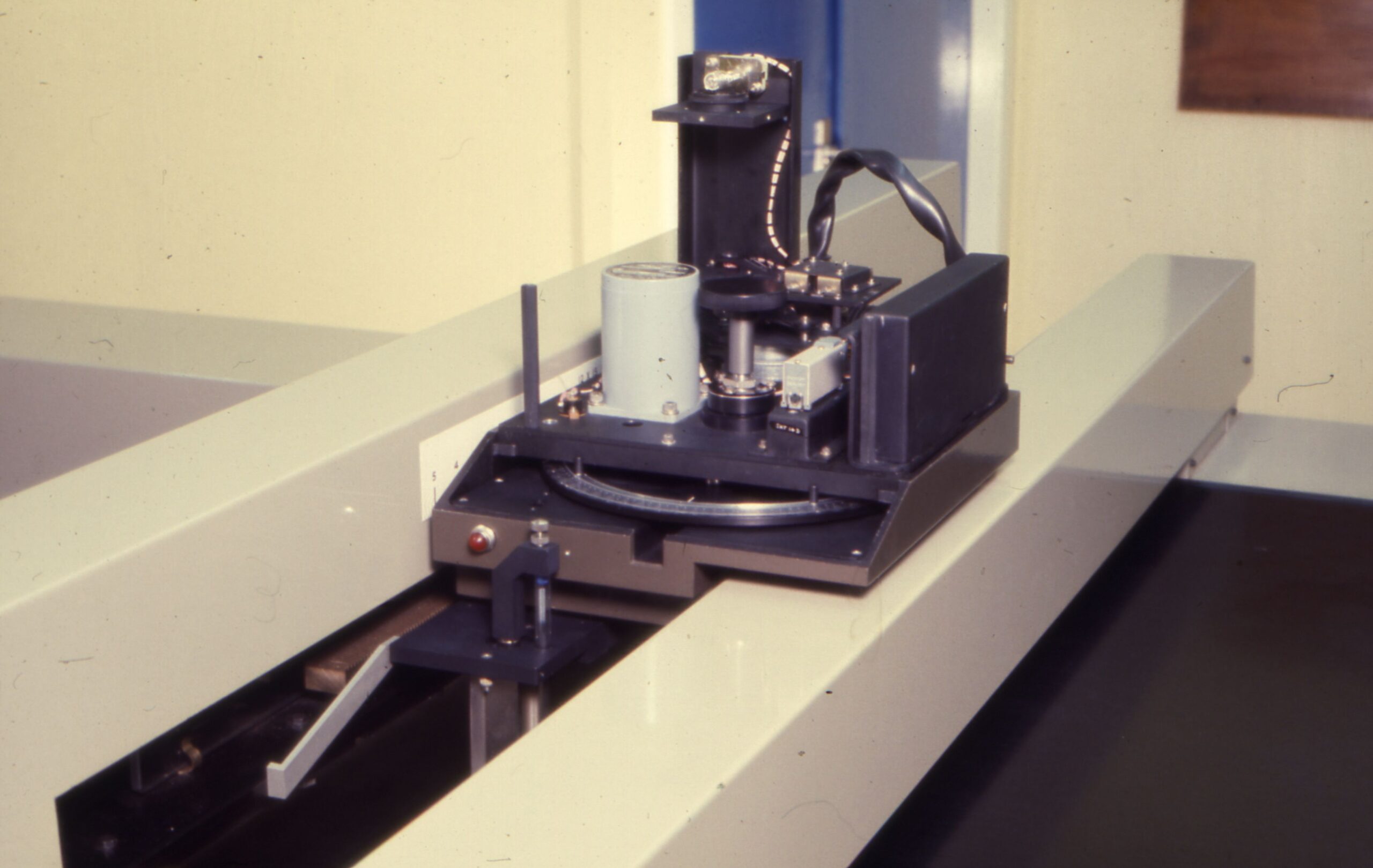
Ferranti master plotter – print head. 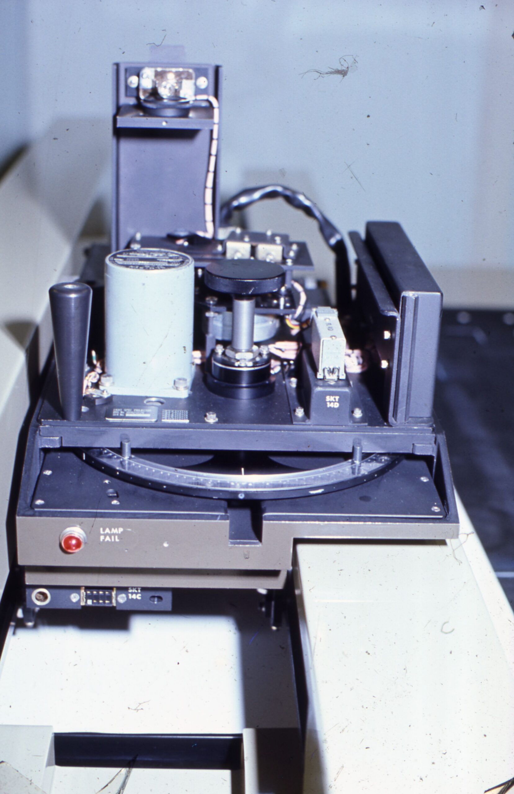
Ferranti master plotter – print head. 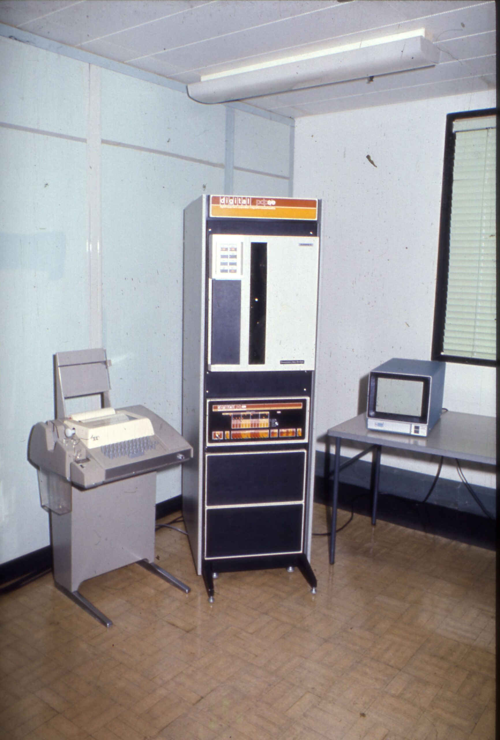
Digital pdp8e computer in Repro 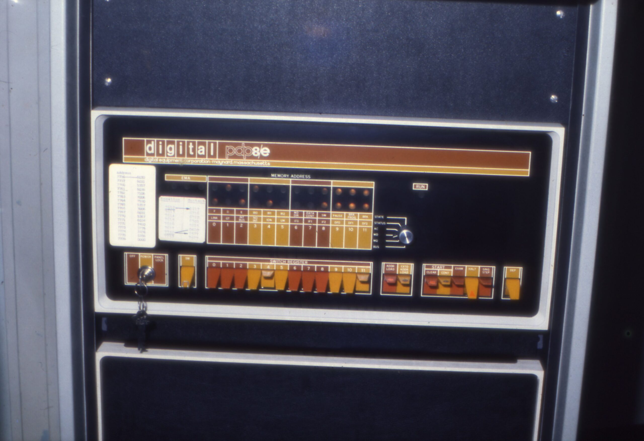
Digital pdp8e CPU and front panel, Repro area
There was also a Xynetics flatbed plotter that printed onto paper and was located in W404 or W407.
After the Ferranti era
By the 1980s, digitising systems had evolved to have VDUs showing the map in progress, this must have been a revolution for staff doing the work, with the first one being introduced in 1982. The blind digitising process was frustrating for some staff but it continued until at least 1991.
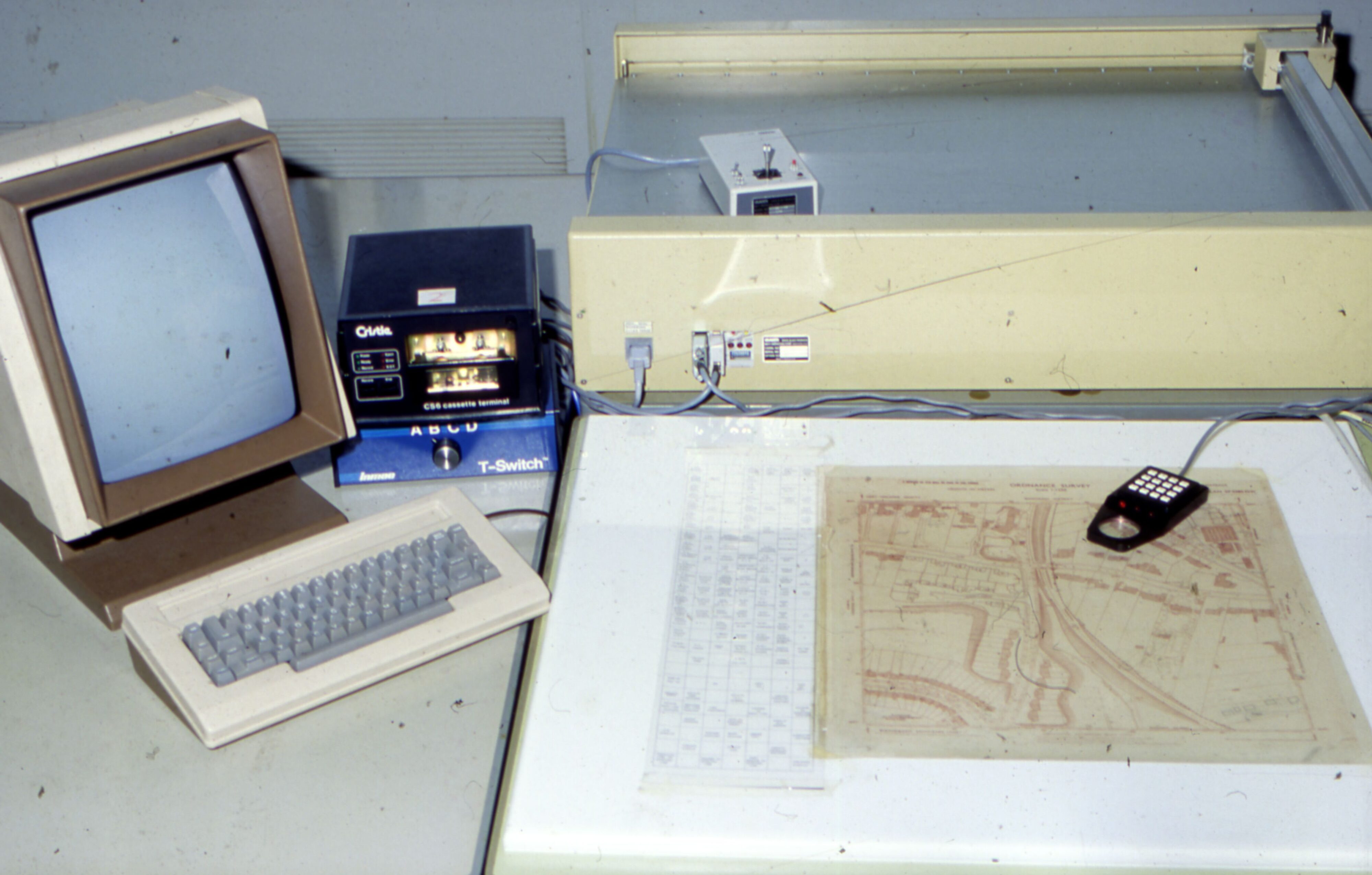
Laser-Scan Integrated Graphics Editing System units with monochrome screens were one of the main digitising tools and these stations also had a terminal with VDU. Prior to this, there were some digitising stations with just a terminal VDU in terms of output device. There were large 3-bay Digital computers with huge tape drives located within the digital mapping offices, presumably to record the data created by staff so it could be transferred to the master databank in the computer room and also so they could be plotted.


By 1985, conventional map production flowlines were being wound down, and some of the digitising work was outsourced to private contractors although it took some time for them to meet the exacting OS specification plus the need for quality control of the outsourced work was not always economically viable but with the aid to production, the last 1:1,250 scale map was digitised – making OS the first national mapping agency in the world to have accomplished this.
Digital Field Update System (DFUS)
Digital Field Update System (DFUS) was a system allowing field surveyors to digitise their own work instead of creating Master Survey Drawings (MSDs) on stable film and sending them to HQ. In reality, each field office generally had a draughtsperson to digitise the work of the surveyors at that office.
See this page for the full story.
Last updated on Friday 19 February 2021 by GaryReggae