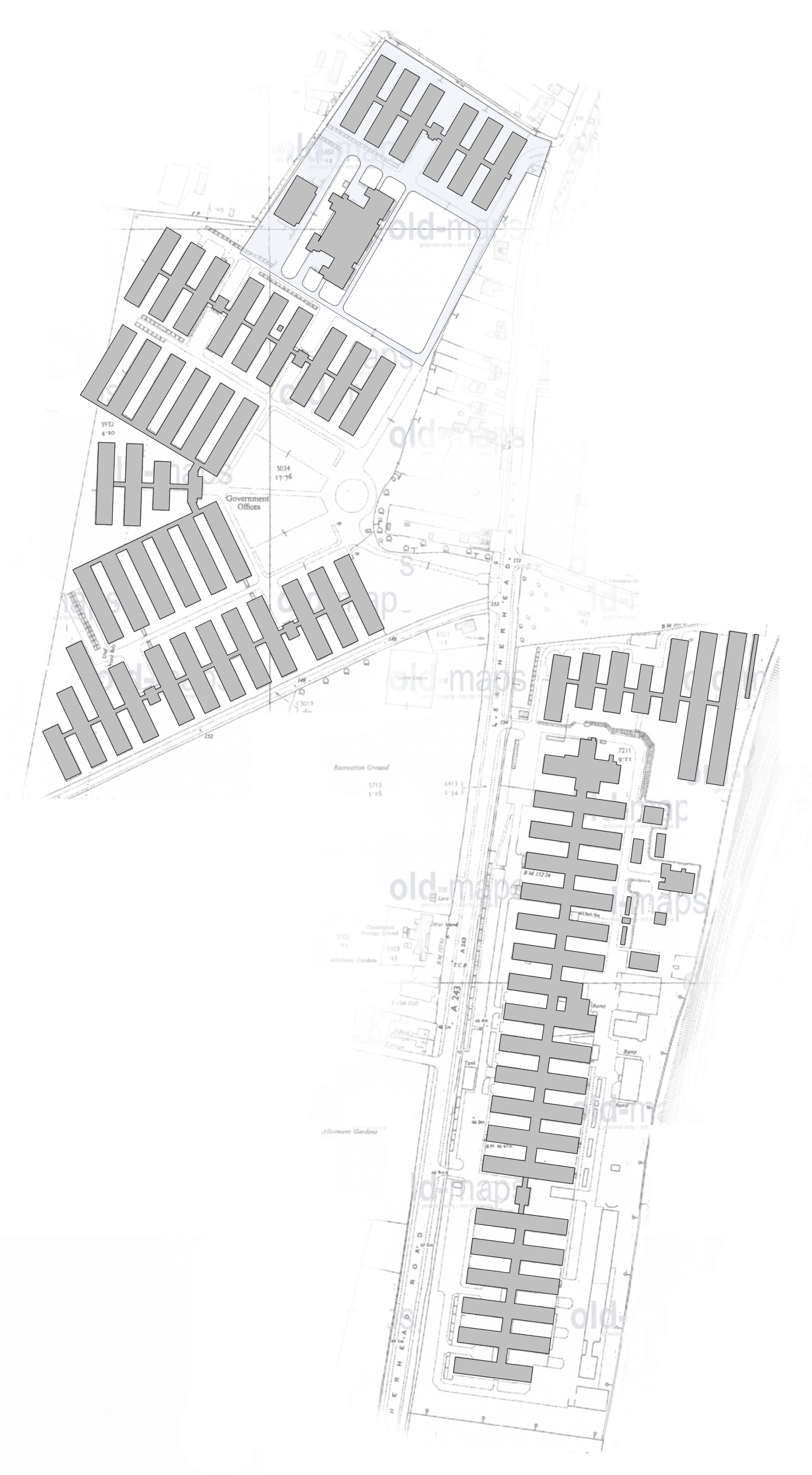
A map of the temporary buildings at Chessington in the 1960s. Whether these were all used by Ordnance Survey or not is currently unknown.
Chessington Map 1960s |
|
See full size image Caption: Site layout plan of temporary buildings at Chessington, these may not all have been used by OS. Description: A map of the temporary buildings at Chessington in the 1960s. Whether these were all used by Ordnance Survey or not is currently unknown. Alt text: Site layout plan of OSO Chessington Image credit: Gary Tull Photo subject date: |